Ronda and the west of Málaga
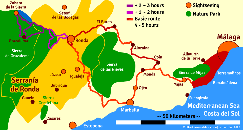

Stages of the route
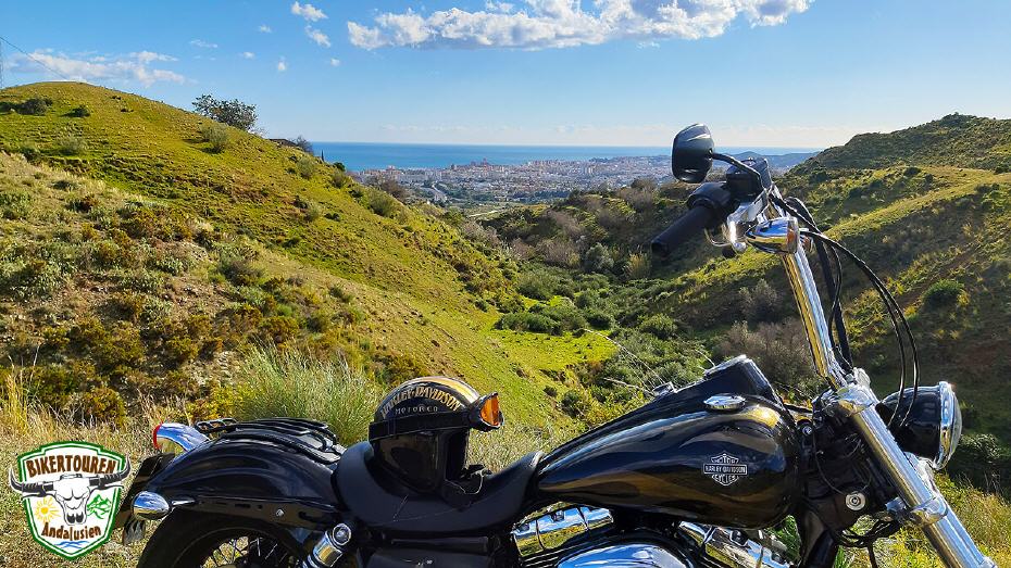
- Drive to the Sierra de Mijas | The Sierra de Mijas near the coast reaches an altitude of 1,150m (Pico Mijas) and offers impressive views of the coast from Málaga to Fuengirola. Mijas is a place with a typical Moorish past. But the Romans, the Phoenicians, the Greeks have also left historical traces in this tranquil place. The most striking attraction, which cannot be overlooked, apart from the typical whitewashed houses, are the unusual donkey taxis. [Note: A shortened version of the route bypasses the centre of Mijas].
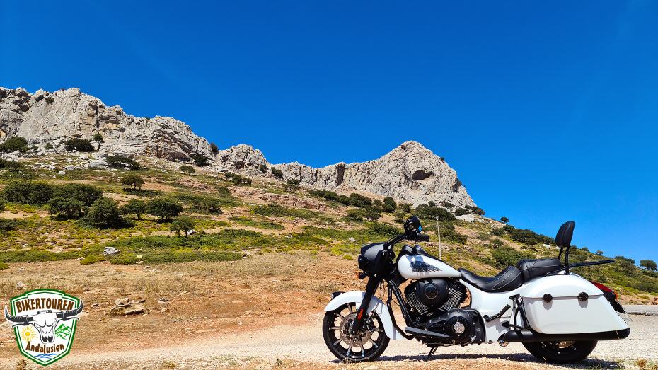
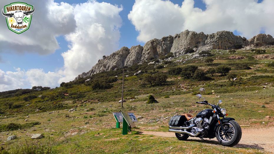
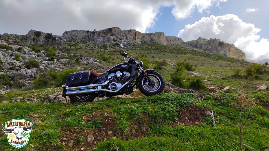
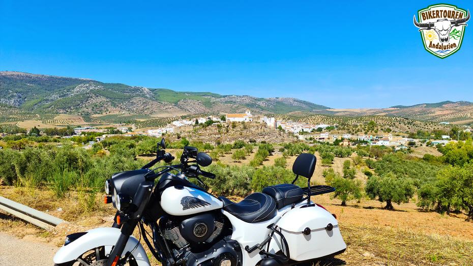
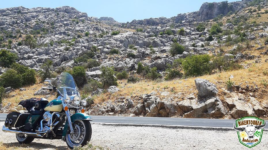
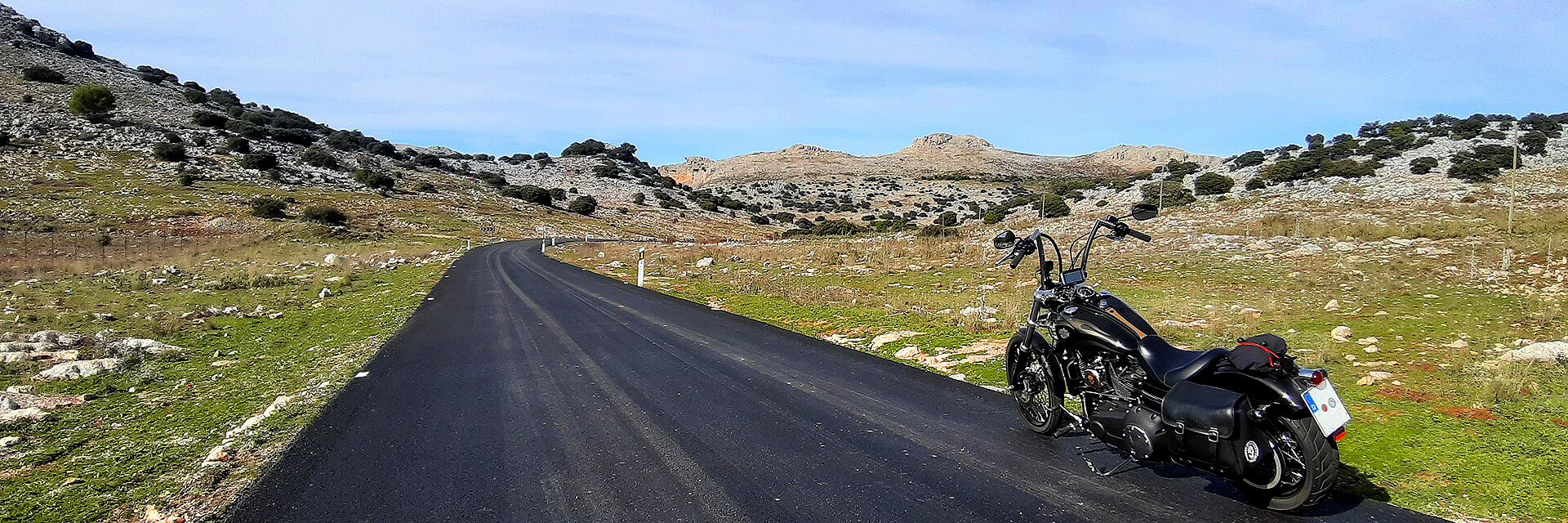
- Via Coin into the Sierra de las Nieves National Park to El Burgo | The Spanish government granted the Sierra de las Nieves national park status in July 2021. Already in 1995, the area around the park, which is geographically characterised by steep mountains, partly snow-covered peaks (hence the name "snow mountains") and deep gorges as well as rocky streams, has also been allowed to adorn itself with the title of a UNESCO biosphere reserve. The highest mountains are Torrecilla (1,919m), Enamorados (1,775m) and Cerro Abanto (1,450m). El Burgo's recent history is linked to the romantic impression of the highwaymen of the Serranía de Ronda. El Burgo was the birthplace of "Pasos Largos", the last highwayman who was still doing his "mischief" in the Sierras at the beginning of the 20th century.
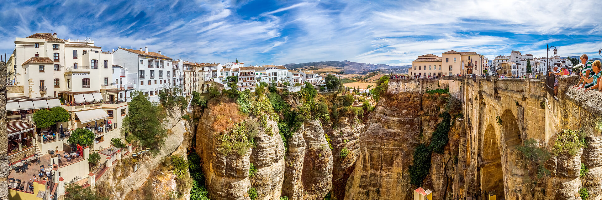
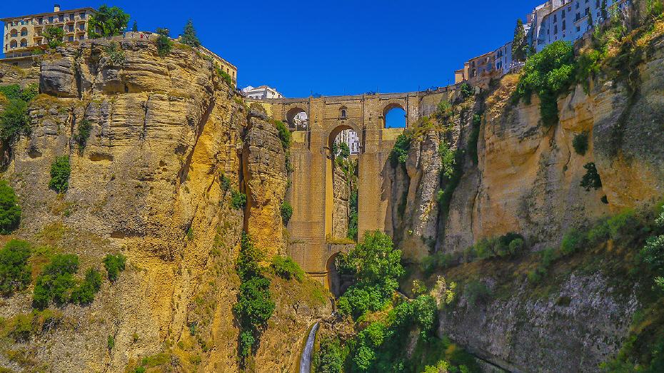
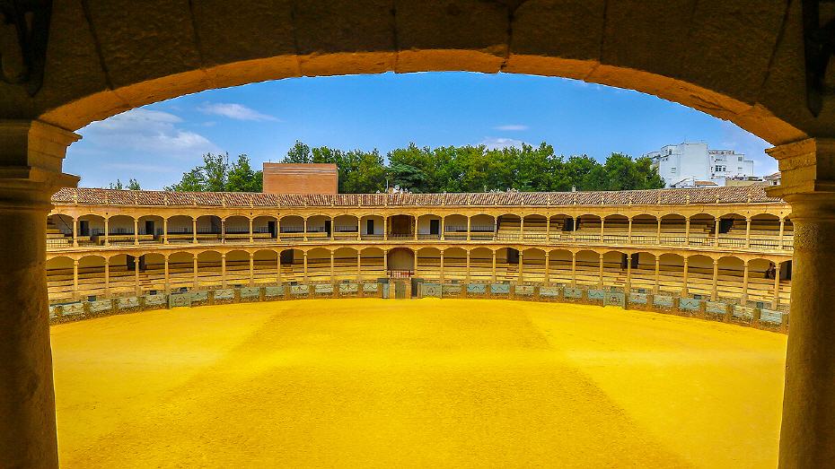
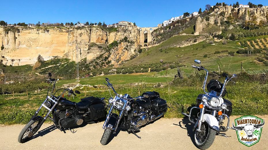
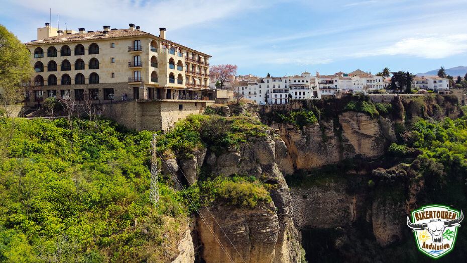
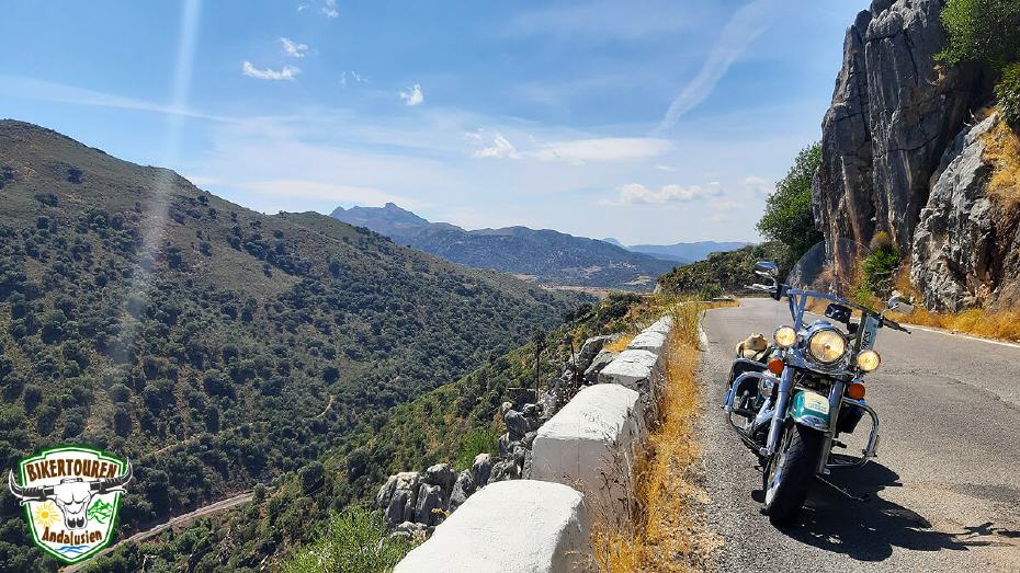
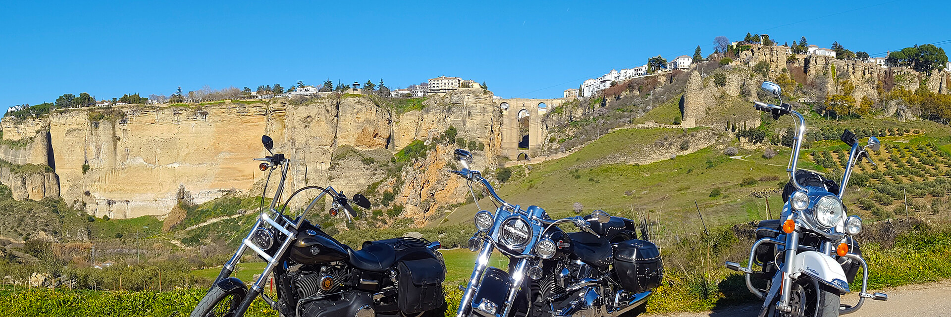
- Through the Serranía de Ronda to Ronda | Ronda, which is over a thousand years old, lies at an altitude of 723m and is one of the most famous "white villages" in Andalusia. Ronda is best known for its Moorish-influenced old town. It is situated on a steeply sloping rock plateau with the Puente Nuevo bridge, which is impressive from many perspectives. It spans the imposing 120-metre-deep El Tajo gorge. The city also has many architectural beauties, including one of the oldest bullrings in Spain. Starting in the 18th century, three generations of the Romero family, all born in Ronda, developed the rules of modern bullfighting. These include the use of the scarf and the "Escuela Rondeña" poses. For an informal tour, the tour guide also stays with the bikes for safety reasons. Helmets and clothing can therefore remain on the bike.
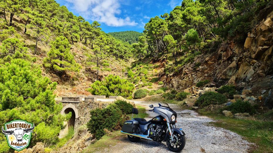
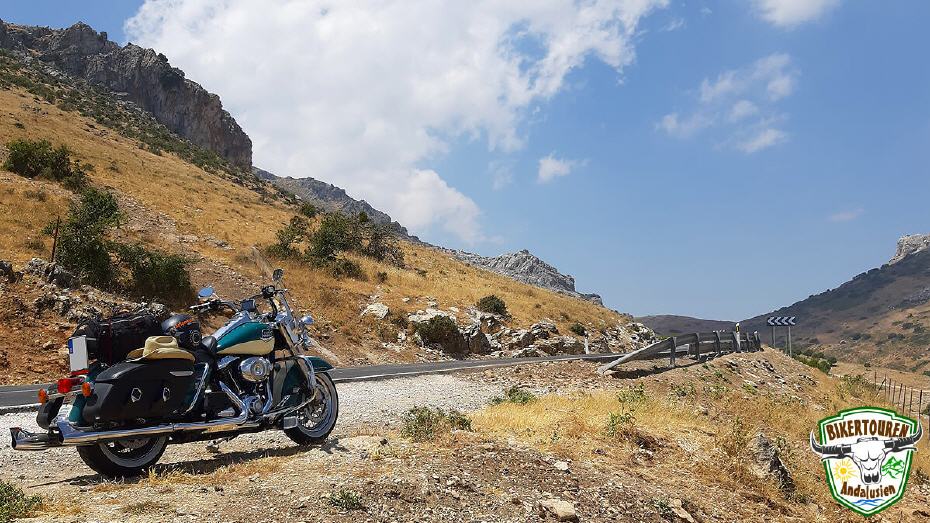
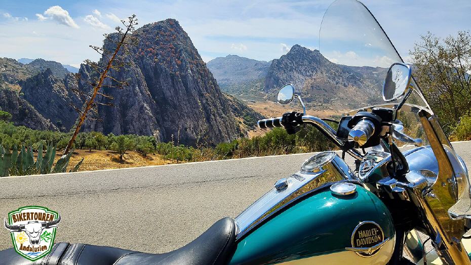
- [Route extension] Drive into Andalusia's green heart - the Sierra de Grazalema Nature Park | With numerous peaks up to 1,654m high (peak of the Torreón), the steep mountain massif stands out from the 300m to 400m high hilly country all around. In 1977 the area was declared a biosphere reserve by UNESCO and in 1984 it was designated as Andalusia's first nature park. The vegetation is characterised by holm oaks, cork oaks and Portuguese oaks. There are countless caves and grottos, e.g. the Complejo Hundidero-Gato, the largest cave in Andalusia, or the Cueva de la Pileta, which is known worldwide for its prehistoric traces.
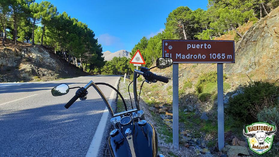
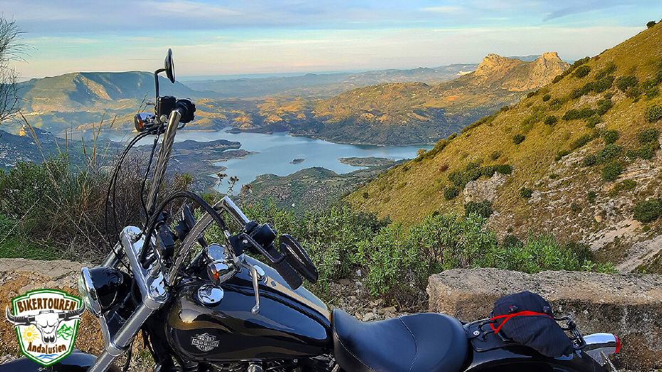
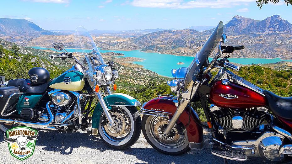
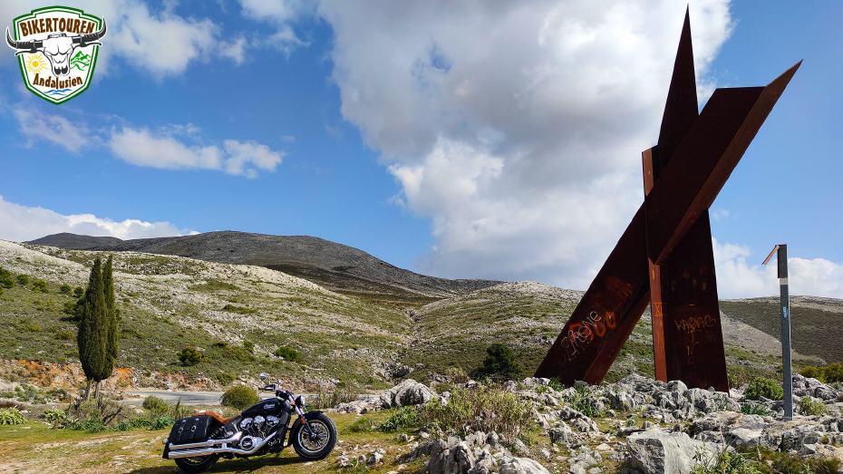
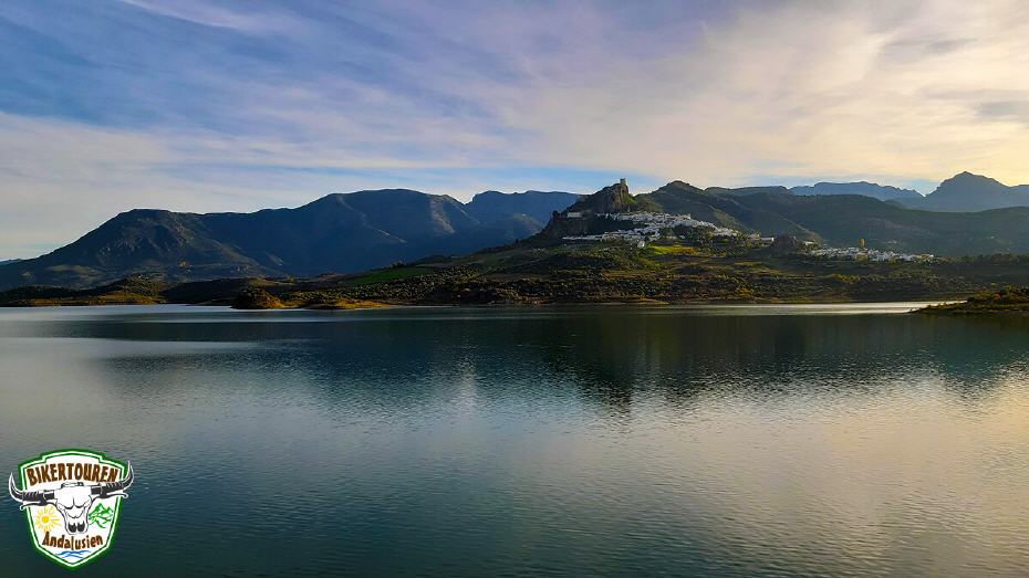
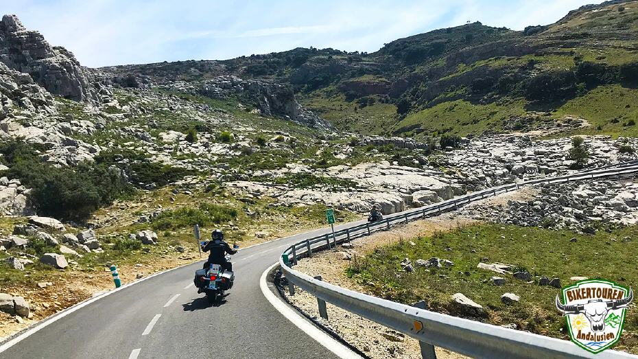
- [Route extension] Over the mountain pass Puerto de las Palomas to Zahara de la Sierra | The 1,357m high and serpentine pass owes its name to the pigeons (Spanish: Palomas), which like to cross the mountains in this area. Zahara de la Sierra is located on the Ruta de los Pueblos Blancos, picturesquely perched on a mountain cone. From there you have a fantastic view over the surrounding countryside and the reservoir. Zahara de la Sierra was founded by the Moors in the eighth century. The word "Zahara" comes from Arabic and means flower.
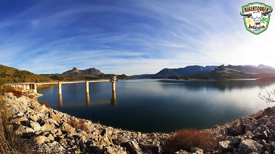
- [Route extension] Along the southern shore of the Zahara el Gastor reservoir | Popular as a bathing water in the region, the reservoir is often featured in TV reports, films and brochures and is one of the most popular photo motifs in Andalusia.
- Through the Serranía de Ronda via the A397 the coast | The very well-maintained road along the Sierra de las Nieves Nature Park leads from Ronda to San Pedro de Alcantara and is a "must drive" among motorcyclists on the way to the coast.
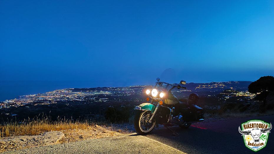
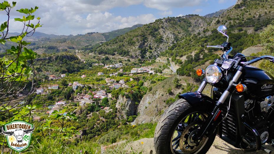
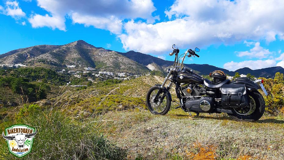
- Along the Sierra Blanca via Ojén to Benalmádena | The white village of Ojén, with over 1,000 years of cultural history, offers a magnificent view of the Sierra Blanca Natural Park. The Sierra Blanca forms the spectacular hinterland of Marbella. The name means "white mountain range", which comes from the marble rock.
There are traditional ventas (inns) all along the route. There is always plenty of time for a rest with delicious tapas, Spanish desserts, ice cream and drinks. Throughout the ride, there are plenty of opportunities for spectacular group photos. We decide individually at the numerous photo points when to allow the tyres to cool down.
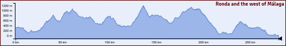
Heightgraph
Visit us on:![]()
![]()
![]()
![]()
Come to the sunny curve paradise!

